

Introduction to How Far Is Muktinath from Kathmandu
Ask the and you’ll get a genuinely confusing spread of answers: 371 km on one site, 395 km on another, 401 km on a third, and some tour operators quoting 450–480 km. None of these are typos — they’re measuring slightly different routes, rounding differently, or in one case using a mapping tool that calculates a straighter theoretical path rather than the actual drivable road. That inconsistency matters if you’re trying to book transport or estimate how many days to set aside.
This guide breaks the journey into its real, verifiable segments, explains exactly where the different totals come from, and lays out every practical way to cover the distance — by road, by flight-and-jeep combination, by helicopter, and on foot — with honest time and cost figures for each. We’ve built this from years of running trips into Mustang with Trek Trove Nepal, moving people along every version of this route.
Quick Answer
- Total road distance, Kathmandu to Muktinath: approximately 390–400 km, most commonly cited as 395–401 km via the standard Pokhara–Beni–Jomsom route
- Total driving time (non-stop, theoretical): 12–15 hours — not something anyone should actually attempt in one push
- Recommended driving duration: 2–4 days with overnight stops
- Fastest option (flights): roughly 2–2.5 hours of actual flying time across two short domestic flights, plus a short jeep transfer — typically done as a 2–3 day trip once ground transfers and buffer time are included
- By helicopter direct from Kathmandu: roughly 1 to 1.5 hours of flight time one-way; full day-tour packages including ground time at the temple typically run 3–5 hours total
- On foot (as part of the classic Jomsom Muktinath trek): effectively the same total distance, covered over 8–10 walking days rather than driven in one go
Why the Distance Figure Varies So Much
Before breaking down the route, it’s worth resolving the actual source of the confusion, because it’s not random.
371 km comes from route-planning and mapping tools that calculate distance via Pokhara, Tatopani, Myagdi, and Jomsom using a generalized routing algorithm — useful as a rough estimate, but not always reflecting the exact road actually driven by tour operators on the ground, particularly the final unpaved stretch into Ranipauwa.
395–401 km is the figure most commonly quoted by Nepal-based trekking and jeep-tour operators who run this route regularly, typically broken down as roughly 200–206 km from Kathmandu to Pokhara, plus roughly 180–195 km from Pokhara to Muktinath via Beni, Tatopani, Ghasa, Marpha, and Jomsom. This is the number we consider most reliable for practical trip planning, since it comes from operators actually driving the road rather than a generic mapping calculation.
450–480 km appears on a smaller number of sites and tends to reflect either a more conservative, rounded-up estimate, a scenic-detour version of the route (via Ghandruk, for instance), or simply an operator padding the figure. It’s not necessarily wrong for the specific route they’re describing, but it’s not the standard, shortest drivable path.
For practical purposes, plan around 390–400 km one-way, and treat any figure outside the 370–480 km range you encounter as either a different specific route or an error.
The Route, Broken Into Real Segments
The most reliable way to understand this distance is segment by segment, since that’s how the road actually works — it isn’t one continuous highway, but four distinct stages with very different surfaces and driving conditions.
| Segment | Route | Distance | Driving Time | Road Surface |
|---|---|---|---|---|
| 1 | Kathmandu → Pokhara | 200–206 km | 6–7 hours | Paved highway (Prithvi Highway) |
| 2 | Pokhara → Beni | 75 km | ~3 hours | Paved |
| 3 | Beni → Tatopani | 40 km | ~2.5 hours | Rough dirt, along the gorge wall |
| 4 | Tatopani → Ghasa/Lete | 30 km | ~2 hours | Gravel, the deepest section of the gorge |
| 5 | Lete → Marpha → Jomsom | 35 km | ~2 hours | Gravel, riverbed sections |
| 6 | Jomsom → Kagbeni → Muktinath | 18–21 km | 1–1.5 hours | Mostly blacktop, some rough patches near the top |
Add segments 2 through 6 together and you get roughly 198–200 km from Pokhara to Muktinath, which combined with the 200–206 km from Kathmandu to Pokhara lands almost exactly on the commonly cited 395–401 km total — which is why we consider that range the most defensible figure for the full journey.
Only the first 75 km beyond Pokhara (to Beni) is reliably paved; everything from Beni onward is a mix of gravel, dirt, and partially paved sections that are actively being upgraded but still vary year to year in condition.
How Far Is Muktinath from Pokhara Specifically?
Because most itineraries actually start counting from Pokhara rather than Kathmandu — since nearly everyone breaks the journey there overnight — this sub-distance deserves its own clear answer.
| Metric | Figure |
|---|---|
| Pokhara to Jomsom (road) | ~180 km |
| Pokhara to Muktinath (road, continuing past Jomsom) | ~198–200 km |
| Pokhara to Jomsom (flight) | 20–25 minutes, ~80–95 km straight-line |
| Driving time, Pokhara to Jomsom | 7–9 hours |
| Driving time, Pokhara to Muktinath | 8–9 hours total |
This is the segment most travelers actually experience as “the journey” — the Kathmandu–Pokhara leg is a fairly standard highway drive or short flight, while the Pokhara–Muktinath leg is where the real adventure, and the real distance-versus-time mismatch, happens. Covering under 200 km can take a full working day of driving, purely because of road surface and the winding gorge terrain.
All the Ways to Cover the Distance
There are four genuinely distinct methods of reaching Muktinath from Kathmandu, and they differ enormously in time, cost, and comfort for essentially the same total distance covered.
| Method | Total Time | Relative Cost | Comfort Level |
|---|---|---|---|
| Full overland by jeep/bus | 2–4 days (with overnight stops) | Low–moderate | Long days, increasingly rough road past Beni |
| Flight + flight + jeep | 2–3 days including buffer | Moderate | Fast, weather-dependent |
| Flight to Pokhara + overland jeep | 2–3 days | Moderate | Balances speed and scenery |
| Direct helicopter | Single day (round trip) | High | Fastest and most comfortable, weather-dependent |
| Trekking (as part of a multi-day trek) | 9–11 days | Moderate–high (guide/porter fees) | Slowest, most physically demanding, most scenic |
Option 1: Full Overland by Jeep or Bus
This is the classic, budget-friendly route: Kathmandu to Pokhara on the paved Prithvi Highway, then Pokhara to Muktinath via Beni, Tatopani, Ghasa, Marpha, Kagbeni, and the final climb to Ranipauwa. Driven non-stop, the theoretical total driving time is 12–15 hours — but nobody sensibly attempts this in one push, both because of driver fatigue on genuinely difficult mountain roads and because it skips any altitude acclimatization entirely.
Realistically, this route is done over 2 to 4 days: one day Kathmandu to Pokhara, one to two days Pokhara to Muktinath (often with an overnight in Tatopani or Marpha), and a similar return. A private 4WD jeep is strongly recommended over a standard car for the sections beyond Beni, where the road includes rough, sometimes bumpy stretches, particularly during and after the monsoon when construction and weather can affect surface quality.
Option 2: Flight + Flight + Jeep (The Fast Route)
This is the quickest realistic way to cover the distance: a roughly 25-minute flight from Kathmandu to Pokhara, followed by a roughly 15–25 minute flight from Pokhara to Jomsom, then a short jeep transfer of about 1 to 1.5 hours up to Muktinath. In terms of actual flying and driving time, this is well under three hours — the reason most pilgrimage tour itineraries built around this method still run 2 to 3 days is departure timing (Jomsom flights only operate in the early morning) and a sensible buffer day, not the raw travel time itself.
Jomsom flights are notoriously weather-dependent — Mustang’s strong afternoon winds mean flights operate almost exclusively in a narrow early-morning window, and delays or cancellations are common enough that building in a spare day is standard practice for any itinerary relying on this method.
Option 3: Fly to Pokhara, Then Drive Overland to Muktinath
A middle-ground option: skip the Kathmandu–Pokhara road leg by flying (saving roughly 6–7 hours), then continue the Pokhara–Muktinath stretch by jeep rather than flying to Jomsom. This trades some of the speed of the full-flight option for a lower dependency on Jomsom’s unreliable flight schedule, and gives you the scenic overland experience through Beni, Tatopani, and Marpha that a same-day flight itinerary skips entirely.
Option 4: Direct Helicopter from Kathmandu
For travelers prioritizing speed and comfort above all else, a chartered or shared helicopter flies directly from Kathmandu to a helipad near Ranipauwa, from which it’s a short walk (commonly cited as around 15 to 30 minutes, depending on the specific landing point) up to the temple itself. Quoted one-way flight times vary by source — some quote roughly 1 hour 15 minutes of actual flying time, others describe the full round-trip package, including ground time at the temple, as running 3 to 5 hours total. The discrepancy is simply about what’s being measured: pure flight time versus the complete day-tour experience.
This is comfortably the fastest way to physically cover the Kathmandu–Muktinath distance, but it’s also the most expensive by a wide margin, and remains subject to the same wind and weather constraints that affect Jomsom’s fixed-wing flights.
Option 5: Trekking the Distance
If Muktinath is reached as part of a multi-day trek — the classic Jomsom Muktinath Trek via Ghorepani and Poon Hill, for instance — the same overall geography is covered on foot over roughly 8 to 10 walking days, typically flying out from Jomsom at the end rather than walking the full distance both ways. This isn’t a faster or shorter path in terms of raw distance; it’s a fundamentally different way of experiencing the same journey, prioritizing gradual altitude acclimatization and scenery over speed.
Travel Time Comparison at a Glance
| Method | Kathmandu → Muktinath Time | Notes |
|---|---|---|
| Non-stop driving (not recommended) | 12–15 hours | Skips acclimatization, exhausting, not advisable |
| Overland with sensible stops | 2–4 days | Most budget-friendly, most scenic overland option |
| Flight + flight + jeep | 2–3 hours of actual travel, 2–3 days total itinerary | Fastest common method, weather-dependent |
| Direct helicopter | 1–1.5 hours flight time one-way; 3–5 hours for a full day-tour package | Fastest overall, most expensive |
| Trekking | 8–10 days | Slowest, most physically demanding, most immersive |
Cost Comparison
Costs vary by group size, season, and operator, but the relative ordering is consistent.
| Method | Relative Cost | What Drives the Price |
|---|---|---|
| Overland jeep/bus | Lowest | Vehicle hire, fuel, driver, accommodation nights |
| Flight + flight + jeep | Moderate | Two domestic flight tickets plus jeep transfer |
| Trekking itinerary | Moderate–high | Guide/porter fees, permits, multiple teahouse nights |
| Direct helicopter | Highest by a wide margin | Aircraft charter cost, typically several thousand US dollars for a private charter, considerably less per person on a shared group flight |
Domestic flight fares (Kathmandu–Pokhara, Pokhara–Jomsom) are relatively fixed and modest compared to the helicopter option, which is priced per aircraft rather than per seat — meaning a shared group flight brings the per-person cost down substantially compared to a solo private charter.
What Actually Affects How Long the Journey Takes
The raw distance number is almost the least useful piece of information for planning purposes — what actually determines your travel time is a handful of variable factors worth understanding.
- Road construction and seasonal damage. The stretch beyond Beni is under ongoing improvement work in sections, and monsoon rains can temporarily worsen surface conditions or, in worse years, cause localized landslides that require detours or waiting.
- Season. Driving the overland route in autumn or spring, when weather is stable, is meaningfully faster and more predictable than attempting it in monsoon (landslide risk on lower sections) or deep winter (occasional snow and ice on higher stretches).
- Flight reliability. Because Jomsom flights operate only in a narrow early-morning window and are sensitive to wind, any itinerary relying on this leg needs schedule flexibility — a delayed or cancelled flight can turn a 2-day fast itinerary into a 3-day one with an overland fallback.
- Vehicle type. A proper 4WD jeep handles the gravel and riverbed sections from Beni onward considerably better and faster than a standard car or bus, particularly after rain.
- Number of stops. Nearly every sensible itinerary breaks the journey with an overnight in Pokhara and often another in Tatopani or Marpha — these aren’t wasted time, they’re what keeps the trip from being an exhausting non-stop slog and they help with gradual altitude adjustment as you climb from roughly 820 meters in Pokhara to nearly 3,800 meters at Muktinath.
Distance and Altitude Gain, Side by Side
Because this is as much an altitude journey as a distance one, it’s worth seeing both together.
| Location | Distance from Kathmandu (road) | Altitude |
|---|---|---|
| Kathmandu | 0 km | ~1,400 m |
| Pokhara | ~200–206 km | ~820 m |
| Beni | ~275–280 km | ~830 m |
| Tatopani | ~315–320 km | ~1,190 m |
| Ghasa/Lete | ~345–350 km | ~2,010–2,500 m |
| Jomsom | ~380–385 km | ~2,720 m |
| Kagbeni | ~390 km | ~2,804 m |
| Muktinath (Ranipauwa/temple) | ~395–401 km | ~3,710–3,800 m |
Notice that the biggest altitude jump on the whole route — from Pokhara’s 820 meters to Jomsom’s 2,720 meters — happens over the final, roughest 180 km of the journey, not gradually across the whole 400 km. This is exactly why the last stretch of this route, however you cover it, deserves more planning attention than the relatively straightforward first 200 km to Pokhara.
Sample Itineraries by Distance Covered Per Day
3-day fast itinerary (flight-based):
- Day 1: Kathmandu → Pokhara (flight, ~140 km straight-line distance covered in 25 minutes)
- Day 2: Pokhara → Jomsom (flight) → Muktinath (jeep) — roughly 200 km covered in under 2 hours combined
- Day 3: Return via the same route
5–6 day overland itinerary:
- Day 1: Kathmandu → Pokhara (206 km, 6–7 hours)
- Day 2: Pokhara → Jomsom (180 km, 7–9 hours)
- Day 3: Jomsom → Muktinath and back, plus exploration (18–21 km each way)
- Day 4–5: Return journey, often with an overnight stop in Tatopani or Marpha
9–11 day trekking itinerary:
- The same approximate 200 km from Pokhara to Muktinath is covered on foot via Nayapul, Tikhedhunga, Ghorepani, Tatopani, Ghasa, Marpha, and Kagbeni, over 8 to 9 walking days, typically flying back from Jomsom to save the return distance.
Does the Distance Change Depending on the Season?
The physical road distance obviously doesn’t change, but the effective distance — how long it takes and how reliably you can cover it — shifts noticeably by season.
| Season | Road Conditions | Flight Reliability | Practical Effect |
|---|---|---|---|
| Spring (Mar–May) | Generally good | Good | Most predictable travel times |
| Summer/Monsoon (Jun–Aug) | Risk of landslides on lower sections (Beni to Tatopani especially) | Lower, due to cloud cover | Build in extra buffer days |
| Autumn (Sep–Nov) | Best conditions of the year | Best of the year | Most reliable travel window |
| Winter (Dec–Feb) | Generally passable, occasional snow on higher stretches | Moderate, cold-related fog risk | Workable but less predictable than autumn |
Is There a Shorter Route?
A reasonable question, given how winding the standard Pokhara–Beni–Jomsom road is: is there a shorter way?
Not meaningfully, for road travel. The standard route via Beni and Tatopani is the established, maintained road connection into the upper Kali Gandaki valley, and it’s the route nearly all overland tour operators use. The alternative approach — via Besisahar and Manang on the opposite side of the Annapurna range, crossing Thorong La Pass at 5,416 meters — is not a shorter or faster way to reach Muktinath by any measure; it’s a completely different, much longer trekking route (part of the full Annapurna Circuit) that happens to also end at Muktinath, typically taking well over a week on foot and requiring a high-altitude pass crossing that the standard route avoids entirely. It’s a different journey, not a shortcut.
Flight and helicopter options don’t shorten the physical distance, obviously, but they dramatically shorten the time required to cover it, which is effectively what most travelers mean when they ask about a shorter route.
What This Distance Actually Feels Like on the Ground
The numbers understate how varied this journey feels in practice. The first 200 km, Kathmandu to Pokhara, is a fairly conventional (if winding) mountain highway drive, passing through mid-hill scenery, terraced farmland, and the Trisuli and Marshyangdi river valleys — comfortable, if long.
The character of the trip changes completely past Beni. The road narrows, the surface turns to gravel and dirt, and you’re driving directly through the Kali Gandaki gorge — the deepest gorge on Earth, with Dhaulagiri (8,167 m) and Annapurna I (8,091 m) rising on either side. This section is where travel time stops correlating neatly with distance: 100 kilometers here can take longer than 150 kilometers on the highway below, simply because of the terrain.
The final 18–21 km from Jomsom to Muktinath, by contrast, is mostly blacktop these days and comparatively quick — a reminder that road quality, not raw distance, is the real variable controlling how long any given stretch of this journey takes.
What We’ve Learned Planning This Route
Across the trips we’ve routed into Mustang, the most common planning error isn’t misjudging the total distance — it’s assuming that distance and time scale together evenly across the whole route. They don’t. The 200 km from Kathmandu to Pokhara and the roughly 198 km from Pokhara to Muktinath take almost exactly the same amount of driving time despite one being on a proper highway and the other largely on gravel — which tells you everything about where the real time cost of this journey sits.
At Trek Trove Nepal, we generally steer travelers away from attempting the full distance in a single exhausting push, regardless of which method they’re using, and toward building in at least one overnight stop on the Pokhara–Muktinath leg specifically, since that’s both the roughest stretch of road and the steepest section of altitude gain on the entire route.
Frequently Asked Questions about How Far Is Muktinath from Kathmandu
1. What is the exact distance from Kathmandu to Muktinath?
The most commonly cited and best-supported figure is approximately 395–401 km by road via Pokhara, Beni, Tatopani, and Jomsom. You may also see figures ranging from 371 km (a mapping-tool estimate) to 450–480 km (a more conservative or detour-inclusive figure), depending on the exact route measured.
2. How long does it take to drive from Kathmandu to Muktinath?
Non-stop, theoretical driving time is 12–15 hours, but this isn’t recommended. Realistically, the journey is done over 2 to 4 days with overnight stops, most commonly in Pokhara and sometimes Tatopani or Marpha.
3. What is the distance from Pokhara to Muktinath specifically?
Approximately 198–200 km by road, or roughly 80–95 km by straight-line flight distance to Jomsom followed by an 18–21 km jeep transfer to Muktinath.
4. Is it faster to fly or drive to Muktinath from Kathmandu?
Flying is dramatically faster in terms of actual travel time — a combination of two short domestic flights and a brief jeep transfer covers the distance in a few hours, compared to 2–4 days of overland driving. The trade-off is weather-dependent flight reliability, particularly for the Pokhara–Jomsom leg.
5. Can I take a direct flight from Kathmandu to Muktinath?
There’s no scheduled direct fixed-wing flight; the standard flight route goes via Pokhara and then Jomsom. A direct helicopter charter from Kathmandu to a helipad near Muktinath is available and is the closest thing to a direct flight option.
6. How long does a helicopter take from Kathmandu to Muktinath?
Reported figures vary by source depending on what’s being measured — pure flight time is commonly cited around 1 to 1.5 hours one-way, while full day-tour packages including ground time at the temple typically run 3 to 5 hours total.
7. Why do different websites give such different distance figures for Kathmandu to Muktinath?
Mainly because they’re measuring slightly different things — some use generic mapping-tool routing, others use the specific road actually driven by tour operators, and some describe a scenic-detour version of the route rather than the standard path.
8. Is the road from Kathmandu to Muktinath fully paved?
No. The Kathmandu–Pokhara highway and the first roughly 75 km from Pokhara to Beni are paved. Beyond Beni, the road is a mix of gravel, dirt, and partially paved sections that vary in condition by season and ongoing construction work, though the final stretch from Kagbeni to Muktinath is mostly blacktop.
9. How far is Jomsom from Muktinath?
Approximately 18–21 km by road, typically taking 1 to 1.5 hours by jeep, or roughly 4 to 6 hours on foot if trekking via Kagbeni.
10. Do I need a 4WD vehicle for this route?
For anything beyond Beni, yes — a proper 4WD jeep handles the gravel, riverbed, and rough sections of the road considerably better than a standard car or tourist bus, particularly after rain or in shoulder-season conditions.
11. Is the distance different if I’m trekking rather than driving?
The overall geography covered is similar, but trekking itineraries typically follow a different, more scenic path via Nayapul, Tikhedhunga, and Ghorepani rather than the direct road, covering the distance over 8 to 10 walking days rather than driving it directly.
12. How does Kathmandu to Muktinath compare to Kathmandu to Everest Base Camp in distance?
The comparison isn’t entirely direct since Everest Base Camp isn’t reached by road at all — it requires flying to Lukla and trekking from there. Muktinath, by contrast, is reachable at least partway by road for its entire distance from Kathmandu, which is a meaningful practical difference for travelers weighing the two destinations.
13. What’s the shortest way to reach Muktinath if I only have 2 days?
The flight-plus-flight-plus-jeep combination (Kathmandu–Pokhara–Jomsom–Muktinath) is the fastest realistic option, though a single buffer day is strongly advisable given Jomsom flights’ sensitivity to weather.
14. Does the distance or time change much between seasons?
The physical distance stays the same, but effective travel time and reliability shift meaningfully — autumn offers the most predictable road and flight conditions, while monsoon and winter both introduce a real chance of delays from landslides, road damage, or flight cancellations.
Final Word on How Far Is Muktinath from Kathmandu
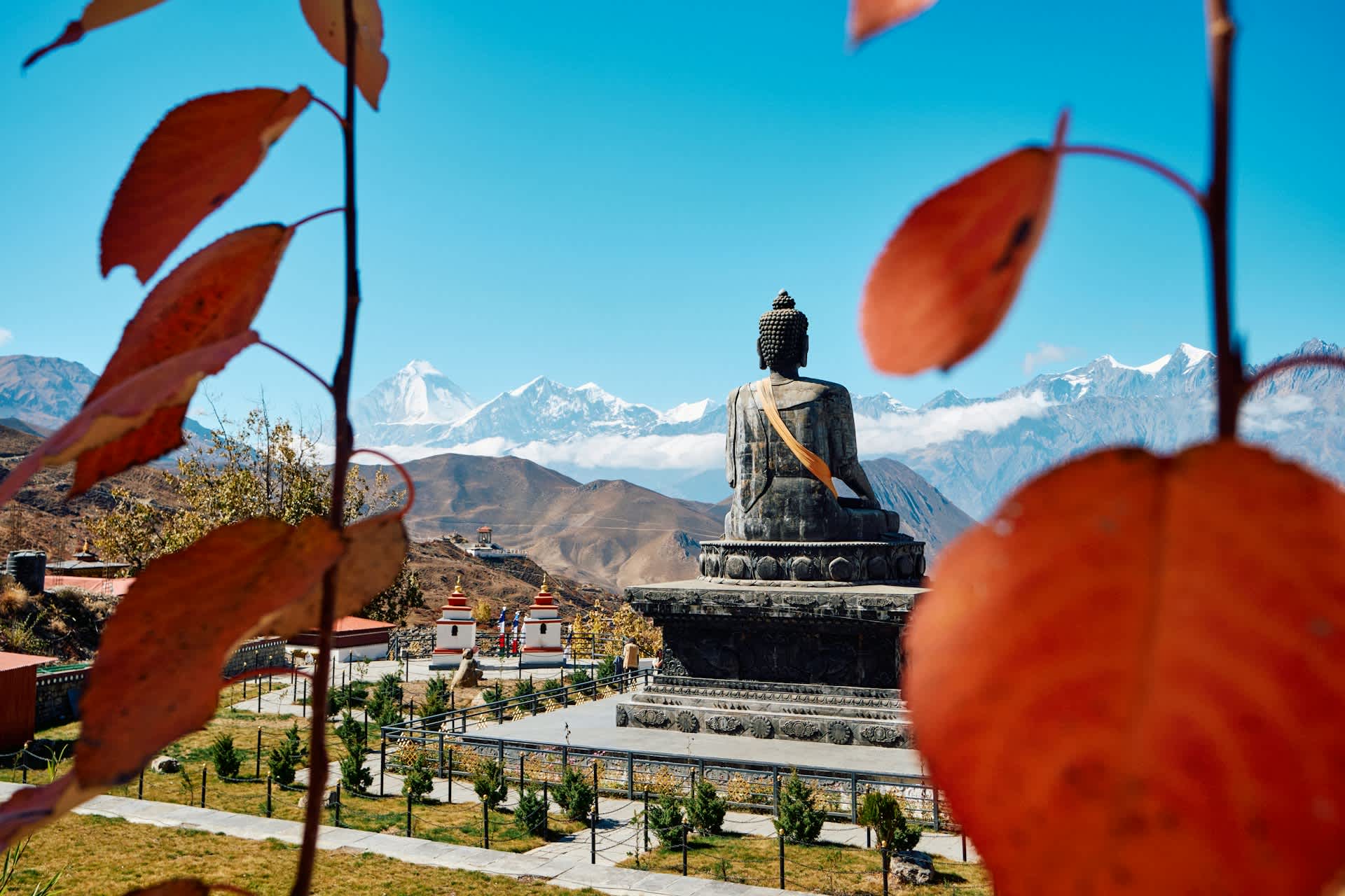
The honest answer to “how far is Muktinath from Kathmandu” is somewhere around 390–400 km by road — but the number that actually matters for planning your trip isn’t the total distance, it’s how unevenly that distance is split between an easy 200 km highway drive and a much slower, rougher 200 km beyond Pokhara.
Whether you cover it by jeep, flight, helicopter, or on foot, plan around that second half, not the number on a map — it’s where nearly all of the journey’s real time, cost, and character actually sit.
