
Introduction to How to Reach Muktinath
The question sounds like a simple logistics query, but the honest answer depends heavily on where you’re starting from, how much time you have, and whether you’re arriving as a pilgrim on a tight schedule or a trekker with two weeks to spare. Most guides answer this with a single generic itinerary and move on. That’s not enough if you’re an Indian pilgrim trying to work out whether to cross the border by land or fly into Kathmandu, or a first-time visitor trying to understand why some tour operators quote a 2-day trip and others quote 10.
This guide covers every genuine way to reach Muktinath — by road, flight, helicopter, and trek — starting from Kathmandu, from Pokhara, and from India, with the practical booking details, costs, and honest trade-offs for each. We’ve built this from years of moving pilgrims and trekkers along every one of these routes with Trek Trove Nepal.
Quick Answer: The Main Ways to Reach Muktinath
| Method | Starting Point | Approx. Time | Best For |
|---|---|---|---|
| Flight + flight + jeep | Kathmandu | 2–3 hours actual travel, 2–3 days total trip | Time-limited pilgrims |
| Overland by jeep/bus | Kathmandu | 2–4 days | Budget travelers, scenic road trip |
| Direct helicopter | Kathmandu | 1–1.5 hrs flight, 3–5 hrs full tour | Fastest, most comfortable, most expensive |
| Flight + jeep | Pokhara | Half a day | Most common single-leg option |
| Overland by jeep | Pokhara | 8–9 hours | Budget-conscious, scenic route |
| Land border + onward travel | India (via Sunauli/Bhairahawa) | 1–3 days to Pokhara, plus onward travel to Muktinath | Indian pilgrims driving in |
| Trekking | Pokhara/Nayapul | 7–11 days | Trekkers wanting the full walking experience |
Where Muktinath Actually Is, and Why That Shapes Every Route
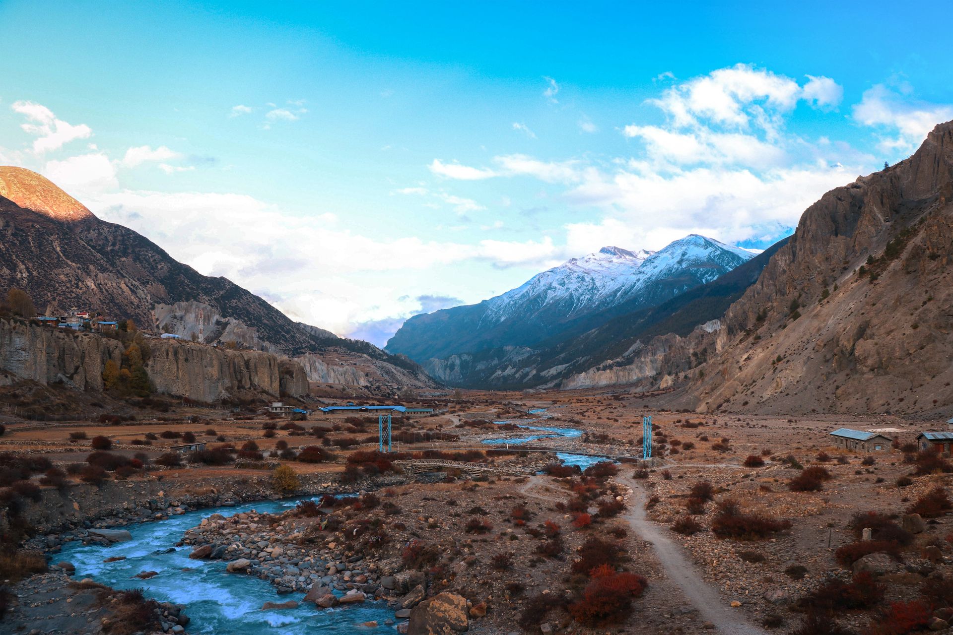
Muktinath sits in the Mustang district of Nepal, in the upper Kali Gandaki valley at roughly 3,710–3,800 meters, at the foot of Thorong La Pass. There is no railway anywhere near it — Nepal has essentially no functioning long-distance passenger rail network — and the nearest airport with regular flight service is at Jomsom, about 18–21 km below Muktinath by road. Every route to Muktinath, regardless of starting point, eventually funnels through one of two gateways: Pokhara, the standard access point, or, less commonly, a direct overland drive from the Nepal-India border through the Terai lowlands and up into the hills.
Understanding this funnel structure makes the rest of this guide much easier to follow: whichever country or city you start in, the real decision points are (1) how you get to Pokhara, and (2) how you get from Pokhara to Muktinath itself.
Getting to Pokhara: The First Half of Nearly Every Route
From Kathmandu to Pokhara
| Method | Distance | Time | Notes |
|---|---|---|---|
| Domestic flight | ~140 km air distance | ~25 minutes | Multiple daily flights, most reliable of any leg on this journey |
| Private car/jeep | ~200–206 km | 6–7 hours | Paved highway (Prithvi Highway) the entire way |
| Tourist bus | ~200–206 km | 6–8 hours | Budget option, scheduled daily departures |
The Kathmandu–Pokhara leg is, by a wide margin, the most straightforward and reliable segment of the entire journey to Muktinath. The highway is fully paved, flights are frequent and rarely weather-affected compared to the notoriously wind-sensitive Jomsom flights further along the route, and both driving and flying options are easy to book through any hotel, travel agency, or online booking platform.
From India to Pokhara
This is where things get genuinely more complex, and it’s worth addressing directly, since a large share of Muktinath’s visitors are Hindu pilgrims traveling from India.
Option A: Fly into Kathmandu, then continue to Pokhara. Kathmandu’s Tribhuvan International Airport has direct flights from several major Indian cities, commonly including Delhi, Mumbai, Kolkata, and Bengaluru, operated by a mix of Indian and Nepali carriers. This is the simplest and most reliable option for most Indian travelers, since Kathmandu’s flight connections are far more established and frequent than any alternative entry point.
Option B: Cross by land at Sunauli/Bhairahawa. The Sunauli border crossing (on the Nepal side, the town is Bhairahawa, officially Siddharthanagar) is the most commonly used land crossing for travelers heading toward Pokhara and onward to Muktinath, since it sits on a direct road route into Nepal’s hill region. Travelers typically reach Sunauli via Gorakhpur in Uttar Pradesh — by train to Nautanwa (the nearest Indian railhead) and then a short local transfer (roughly 5 km) to the border itself — cross into Nepal at Belahiya/Bhairahawa, and continue by road toward Pokhara, a further drive of roughly 175 km, commonly taking around 5 to 9 hours depending on the specific road taken and conditions.
Option C: Fly into Bhairahawa’s Gautam Buddha International Airport. Nepal’s second international airport, located at Bhairahawa near the Sunauli border, opened in 2022 as a gateway primarily for Buddhist pilgrimage traffic to nearby Lumbini. In practice, its international flight schedule has been limited and has fluctuated considerably since opening — at various points it has hosted flights from Thailand, the Gulf, and other regions, with plans periodically announced (and sometimes delayed) for direct India connections. Because these schedules change frequently, don’t treat Bhairahawa as a guaranteed direct route from India without checking current flight availability close to your travel dates — for most travelers today, flying into Kathmandu or crossing overland via Sunauli remains the more dependable path.
| Route from India | Approx. Total Time to Pokhara | Notes |
|---|---|---|
| Fly to Kathmandu, then fly/drive to Pokhara | Varies by origin city + ~25 min to 7 hrs | Most reliable overall |
| Train/road to Sunauli, cross border, drive to Pokhara | Roughly 1–2 days including border formalities | Common for overland pilgrim groups |
| Fly to Bhairahawa (if current schedules allow), drive to Pokhara | Varies, check current airline schedules | Not guaranteed year-round; verify before relying on it |
Whichever way you enter, remember that both India and Nepal require valid documentation at any land border crossing — Indian nationals benefit from the open-border arrangement between the two countries for basic entry, but all other foreign nationals need to check Nepali visa requirements before arriving at any crossing point, and everyone needs to register at the immigration checkpoint when crossing.
From Pokhara to Muktinath: Every Option in Detail
This is the leg where the real trip-planning decisions happen, since it’s the segment with the most genuinely different methods available.
Option 1: Fly to Jomsom, Then Jeep to Muktinath
| Leg | Distance/Time |
|---|---|
| Pokhara to Jomsom (flight) | 20–25 minutes |
| Jomsom to Muktinath (jeep) | 18–21 km, 1–1.5 hours |
This is the single most common way visitors reach Muktinath from Pokhara, and for good reason — it’s fast, scenic, and doesn’t require any trekking fitness. The catch is flight reliability: Jomsom flights operate almost exclusively in the early morning, because Mustang’s notoriously strong afternoon winds, funneled up the Kali Gandaki gorge, make later flights unsafe. Booking the earliest available flight and building in at least one buffer day is standard practice for anyone relying on this leg, particularly outside the stable autumn and spring seasons.
How to book this leg practically: domestic flight tickets for Pokhara–Jomsom can be booked through Nepali domestic carriers directly, through a travel agency, or bundled into a package tour. Given the frequent weather-related cancellations, most experienced operators recommend booking through an agency that can quickly rebook or arrange an overland alternative if your flight is grounded, rather than trying to manage last-minute rebooking independently in Jomsom.
Option 2: Drive the Full Overland Route
| Segment | Distance | Time |
|---|---|---|
| Pokhara to Beni | 75 km | ~3 hours |
| Beni to Tatopani | 40 km | ~2.5 hours |
| Tatopani to Ghasa/Lete | 30 km | ~2 hours |
| Lete to Marpha to Jomsom | 35 km | ~2 hours |
| Jomsom to Kagbeni to Muktinath | 18–21 km | 1–1.5 hours |
Total: roughly 198–200 km, typically 8–9 hours of driving, best split across two days rather than attempted in one long push. Only the first 75 km beyond Pokhara is reliably paved; the rest is a mix of gravel and partially paved sections that vary in condition by season, which is why a proper 4WD jeep — not a standard car or full-size tourist bus — is the recommended vehicle for this stretch.
How to book this leg practically: private jeep hire is arranged through trekking and tour agencies in Pokhara or Kathmandu, typically as a package that includes driver, fuel, and sometimes accommodation along the way. Shared jeeps and local buses also run this route at a lower cost but with less flexibility on timing and stops.
Option 3: Direct Helicopter from Pokhara
| Detail | Figure |
|---|---|
| Flight time | Shorter than from Kathmandu, given the closer starting point |
| Landing point | Helipad near Ranipauwa, short walk (roughly 5–15 minutes depending on the exact landing site) to the temple |
| Cost structure | Priced per aircraft; per-person cost drops significantly with a full group of 4–5 |
Helicopter tours from Pokhara are shorter and less expensive than the equivalent tour from Kathmandu, simply because of the shorter distance covered. They remain the fastest and most comfortable option, at a meaningfully higher cost than flight-and-jeep or overland alternatives, and are still subject to the same wind and weather constraints affecting fixed-wing flights in this region.
How to book this leg practically: helicopter charters are arranged through Kathmandu or Pokhara-based operators, usually with options for a private charter (highest cost, full flexibility) or a shared group flight (lower per-person cost, fixed group departure times).
Option 4: Trekking from Pokhara/Nayapul
For travelers with a week or more, walking to Muktinath — commonly via Nayapul, Tikhedhunga, Ghorepani, Poon Hill, Tatopani, Ghasa, Marpha, and Kagbeni — remains a genuinely popular and rewarding option, typically flying back out from Jomsom rather than walking the return leg.
| Trek Length | What It Includes |
|---|---|
| 7–8 days | Fly in to Jomsom, trek the core route to Muktinath and back down through Marpha and Tatopani |
| 9–11 days | Full walk-in from Nayapul including the Ghorepani/Poon Hill loop |
This is covered in far more detail in a dedicated itinerary guide, but the key access point to understand here is Nayapul, a roughly 1–2 hour drive from Pokhara, which serves as the trailhead for the classic overland trekking approach.
The Full Journey from Kathmandu: All Four Methods Side by Side
| Method | Route | Total Time | Relative Cost |
|---|---|---|---|
| Overland (jeep/bus, both legs) | Kathmandu → Pokhara (road) → Muktinath (road) | 2–4 days | Lowest |
| Flight + flight + jeep | Kathmandu → Pokhara (flight) → Jomsom (flight) → Muktinath (jeep) | 2–3 hours actual travel; 2–3 day itinerary with buffer | Moderate |
| Flight + overland | Kathmandu → Pokhara (flight) → Muktinath (road) | ~9 hours actual travel; 2–3 day itinerary | Moderate |
| Direct helicopter | Kathmandu → Muktinath (helicopter) | 1–1.5 hrs flight; 3–5 hrs full day tour | Highest |
| Trekking | Kathmandu → Pokhara (flight/road) → Nayapul → walk to Muktinath | 9–13 days total, including Kathmandu-Pokhara transfer | Moderate–high |
Practical Booking Tips for Each Method
If you’re booking flights (Kathmandu–Pokhara or Pokhara–Jomsom): book the earliest possible departure, particularly for the Pokhara–Jomsom leg, since afternoon flights face a much higher risk of wind-related delay or cancellation. Confirm your airline’s current cancellation and rebooking policy before travel — this route sees enough weather disruption that flexible tickets are worth the modest extra cost for many travelers.
If you’re hiring a jeep: confirm the vehicle is a genuine 4WD suited to the unpaved sections beyond Beni, not a standard sedan or minivan marketed loosely as a “jeep.” Ask specifically whether the quoted price includes fuel, driver accommodation, and any permit-related paperwork, since these are sometimes itemized separately by budget operators.
If you’re booking a helicopter: clarify whether the quoted price is per person (shared group flight) or for the whole aircraft (private charter) — this is the single most common point of price confusion in helicopter tour marketing, and the difference between the two can be several times the per-person cost.
If you’re planning to trek: book your guide and any required permits (see below) through a registered trekking agency well before arrival, particularly during peak season (October and April), when guide availability and teahouse capacity can genuinely run tight.
If you’re crossing the India-Nepal border overland: carry appropriate identification for entry (a valid passport is strongly recommended even where informal crossing has historically been possible for Indian nationals), and build in buffer time for border formalities, which can take anywhere from a few minutes to a couple of hours depending on time of day and season.
Permits Required to Reach Muktinath
Regardless of which method you use to physically get there, Muktinath sits inside the Annapurna Conservation Area, and reaching it legally requires permits.
| Permit | Cost (2026, foreign nationals) | Required For |
|---|---|---|
| Annapurna Conservation Area Permit (ACAP) | NPR 3,000 (≈ US$23), one-time | All visitors — jeep, flight, helicopter, or trekking |
| TIMS Card | NPR 2,000 (≈ US$15) individual; less for group/SAARC travelers | Trekking itineraries; commonly also required for jeep tours |
| Upper Mustang Restricted Area Permit | US$50 per person, per day inside the restricted zone | Only if continuing north of Kagbeni into Upper Mustang |
These permits are typically arranged through your trekking agency, tour operator, or the Nepal Tourism Board office in Kathmandu or Pokhara — independent travelers should confirm exactly who is handling permit paperwork before departure, since this is one of the most common points of confusion for first-time visitors arranging their own jeep or flight without a full package tour.
Which Method Should You Actually Choose?
Rather than a single universal recommendation, here’s how the choice typically plays out by traveler type.
- Elderly pilgrims on a tight schedule: flight + flight + jeep from Kathmandu, or flight + jeep from Pokhara, with at least one buffer day built in for weather delays.
- Families or groups wanting a shared scenic experience without physical exertion: the overland jeep route, ideally with an overnight stop at Tatopani or Marpha rather than a single exhausting driving day.
- Travelers prioritizing speed and comfort above cost: direct helicopter, either from Kathmandu or, for a shorter and less expensive flight, from Pokhara.
- Budget-conscious travelers with flexible time: overland by shared jeep or local bus, the least expensive way to cover the distance.
- Trekkers wanting the complete Himalayan walking experience: the 7–11 day trekking routes via Nayapul or a shorter fly-in-trek-out version via Jomsom.
- Indian pilgrims driving in as part of a larger Nepal trip (often combined with Pashupatinath in Kathmandu): overland via Sunauli/Bhairahawa to Pokhara, then onward by jeep or flight to Muktinath — commonly bundled into a single multi-day pilgrimage tour package.
What Each Route Actually Feels Like
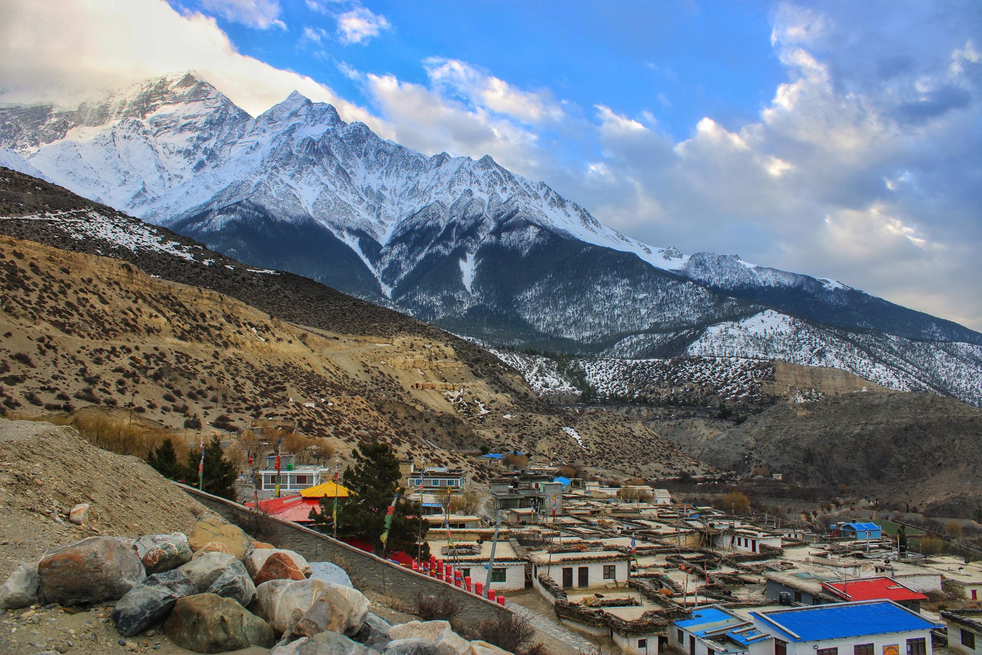
Numbers only tell part of the story. The flight-and-jeep route feels efficient and slightly rushed at the Kathmandu end, but the short Pokhara–Jomsom flight itself is genuinely spectacular — a low-altitude pass between Dhaulagiri and Annapurna, two 8,000-meter peaks, close enough on a clear morning to feel within reach of the aircraft window.
The overland route feels like a proper road trip through changing terrain — subtropical lowlands giving way to the deep, dry gorge of the upper Kali Gandaki, the deepest gorge on Earth, with Thakali and Gurung villages punctuating the journey at Tatopani, Ghasa, and Marpha.
The helicopter route feels, understandably, the most purely logistical of the options — fast, comfortable, and efficient, trading the gradual sense of arrival that road or trekking approaches provide for speed and convenience.
The trekking approach feels like the most complete version of the journey — days of walking through changing landscape and altitude, ending with a genuine sense of arrival at Muktinath’s temple courtyard that the faster methods, by design, don’t replicate.
Seasonal Access Considerations
| Season | Flight Reliability | Road Conditions | Overall Access |
|---|---|---|---|
| Spring (Mar–May) | Good | Generally good | Reliable across all methods |
| Summer/Monsoon (Jun–Aug) | Lower, due to cloud cover | Landslide risk on lower sections (Beni–Tatopani) | Build in extra buffer time regardless of method |
| Autumn (Sep–Nov) | Best of the year | Best of the year | Most reliable window across all methods |
| Winter (Dec–Feb) | Moderate, cold-related fog risk | Generally passable, occasional snow on higher stretches | Workable but less predictable than autumn |
This pattern holds regardless of which method you choose to reach Muktinath — autumn and spring are simply the seasons where every access route performs most predictably, while monsoon and winter both introduce genuine, if manageable, disruption risk.
What We’ve Learned Helping People Reach Muktinath
Across the routes we run at Trek Trove Nepal — flight-based pilgrimage tours, overland jeep trips, and full treks alike — the most common access-related problem isn’t choosing the wrong method, it’s underestimating how much the Pokhara–Muktinath leg specifically can vary from the schedule on paper. A flight delay, a landslide-related road closure, or simply a slower-than-expected drive through the gorge can all turn a tightly planned day into a two-day affair.
Our standard advice, regardless of which method a traveler chooses, is the same one running through this entire guide: build a buffer day into the Pokhara–Muktinath portion specifically, since that’s where nearly every genuine disruption on this route actually happens — not on the reliable, paved Kathmandu–Pokhara leg, and not usually at the temple itself.
Frequently Asked Questions about How to Reach Muktinath
1. What is the fastest way to reach Muktinath from Kathmandu?
A direct helicopter is the fastest, at roughly 1 to 1.5 hours of flight time one-way. The fastest common method without a helicopter charter is flight-plus-flight-plus-jeep via Pokhara and Jomsom, covering the distance in a few hours of actual travel time.
2. Can I reach Muktinath without flying?
Yes — the full overland route by jeep or bus from Kathmandu via Pokhara, Beni, Tatopani, and Jomsom reaches Muktinath entirely by road, typically over 2 to 4 days.
3. Is there a direct flight from Kathmandu to Muktinath?
No scheduled fixed-wing flight goes directly to Muktinath; the standard route flies via Pokhara and then Jomsom. A direct helicopter charter is the closest equivalent to a direct flight.
4. How do Indian pilgrims typically reach Muktinath?
Most fly into Kathmandu, since it has the most reliable flight connections from major Indian cities, then continue to Pokhara and Muktinath by the standard routes. Overland travel via the Sunauli/Bhairahawa border crossing, accessed via Gorakhpur, is a common alternative for those driving or taking the train partway.
5. Can I fly directly from India to somewhere near Muktinath?
Bhairahawa’s Gautam Buddha International Airport is the closest international airport to the Sunauli border, but its international flight schedule has been limited and has changed considerably since opening — check current airline routes close to your travel dates rather than assuming a direct India connection will be available.
6. What permits do I need to reach Muktinath, regardless of route?
At minimum, the Annapurna Conservation Area Permit (ACAP, roughly US$23) and a TIMS card (roughly US$15), required across jeep, flight, and trekking access methods. An Upper Mustang Restricted Area Permit is only needed if you continue north of Kagbeni.
7. How far is Jomsom from Muktinath, and how do I get between them?
About 18–21 km, most commonly covered by jeep in 1 to 1.5 hours, or on foot via Kagbeni in roughly 4 to 6 hours if trekking.
8. Is the overland road to Muktinath safe?
Generally yes, especially in spring and autumn, though the sections beyond Beni are gravel and partially paved, requiring a proper 4WD vehicle, and the route carries a real (though manageable) landslide risk during monsoon.
9. Do I need a guide to reach Muktinath?
For standard jeep and flight-based tours to Muktinath itself, a guide isn’t strictly mandatory but is commonly included in package tours and recommended for permit handling and local knowledge. For any extension into Upper Mustang, a licensed guide and registered agency are compulsory requirements.
10. What’s the best way to reach Muktinath with elderly family members?
Flight-plus-jeep from Pokhara or Kathmandu, with a buffer day built in, is the least physically demanding option. The overland jeep route is a comfortable alternative if flight-related altitude changes are a concern, since it introduces altitude more gradually.
11. How reliable are Jomsom flights?
They’re generally reliable in autumn and spring but operate only in a narrow early-morning window year-round, due to strong afternoon winds, and face a higher chance of delay or cancellation in monsoon and winter.
12. Can I combine a Muktinath visit with a helicopter tour and still see the ground route?
Some operators offer one-way combinations — flying in and driving out, or vice versa — giving a mix of speed and scenery. This is worth requesting directly from your tour operator rather than assuming it’s a standard package option everywhere.
13. Is it possible to reach Muktinath in a single day from Kathmandu?
Only realistically via a direct helicopter day tour. Flight-and-jeep or overland routes from Kathmandu require at least an overnight stop in Pokhara given flight timing and driving distances involved.
14. What’s the most budget-friendly way to reach Muktinath?
Overland by shared jeep or local bus from Kathmandu via Pokhara is the least expensive method, though it requires the most total travel time of any non-trekking option.
Final Word on How to Reach Muktinath
There’s no single correct way to reach Muktinath — the right method depends on your time, budget, physical comfort with altitude changes, and where you’re starting your journey from.
What matters most, across every route in this guide, is understanding that the Kathmandu–Pokhara (or India–Pokhara) leg is almost always the easy, predictable part of the trip, while the Pokhara–Muktinath stretch — however you cover it — is where weather, road conditions, and altitude genuinely deserve your planning attention. Build flexibility into that final leg specifically, and whichever method you choose will get you there with far less stress than the schedule on paper might suggest.