
Introduction to Muktinath Altitude
If you’ve searched this phrase, you’ve probably already noticed the problem: one website says Muktinath sits at 3,710 meters, another says 3,800, a third throws in 3,762, and none of them explain why. That inconsistency isn’t a typo repeated across the internet — it comes from three different things being measured (the temple itself, the village of Ranipauwa below it, and the general “Muktinath area”) and it matters more than it looks, because 90 vertical meters is exactly the kind of number that changes how you should plan for altitude.
This guide gives you the actual figure, explains where each number comes from, and — more usefully — tells you what that altitude actually means for your body, your itinerary, and your packing list. We put this together after years of running trips into Mustang with Trek Trove Nepal, watching which travelers breeze through the altitude change and which ones struggle, and why.
Quick Answer about Muktinath Altitude
- Muktinath Temple altitude: 3,710–3,800 m (12,172–12,467 ft), most precisely surveyed at 3,762 m
- Ranipauwa (the village/jeep-road end below the temple): 3,710 m
- Altitude gain from Jomsom: roughly 1,000–1,080 m over about 18–21 km
- Altitude sickness risk: low-to-moderate if you ascend sensibly; real if you fly or drive straight up in a single day without a buffer
- Comparable to: Everest Base Camp is nearly 2,000 m higher; Muktinath’s altitude alone is rarely dangerous, but it sits close enough to the 2,500–3,500 m zone where AMS symptoms typically start that it deserves respect, not fear
The Real Muktinath Altitude: 3,710m, 3,762m, or 3,800m?
All three numbers are correct — they’re just describing slightly different points on the same hillside.
3,710 meters is the altitude of Ranipauwa, the small settlement where the paved jeep road actually ends and where almost every hotel, teahouse, and shop in “Muktinath” is located. Confusingly, most travelers call this whole area Muktinath, even though the temple itself sits a short, steep walk above it.
3,762 meters is the surveyed elevation of the Muktinath temple complex itself, as recorded on its Wikipedia entry and cross-referenced with geographic databases. This is the most defensible single number if you want one precise figure for the temple structure.
3,800 meters is a rounded figure used by a large share of trekking operators and tour itineraries, often to describe the highest point a visitor reaches once they’ve climbed from Ranipauwa up through the temple courtyard to the uppermost shrines. It’s not wrong, it’s just rounded and slightly generous.
For practical purposes — packing, acclimatization planning, and knowing what your body is dealing with — treat Muktinath as sitting at roughly 3,700–3,800 meters. The 50–90 meter spread between these figures makes no physiological difference; what matters is that you’re pushing well past 3,500 meters, the altitude where doctors start recommending gradual ascent regardless of how fit you are.
Why the Confusion Persists
Three separate things get lumped under “Muktinath” in casual conversation and in search results:
- Ranipauwa — the transport hub and accommodation base (3,710 m)
- The temple complex — a 10–20 minute uphill walk above Ranipauwa (3,762–3,800 m)
- Jharkot — a nearby historic village slightly off the main route, at 3,519 m, sometimes mentioned in the same breath because it’s on older trekking itineraries
If a website you’re reading says “Muktinath is at 3,710m,” it’s almost certainly describing where you’ll sleep. If it says 3,800m, it’s describing where you’ll stand when you actually visit the shrine. Both are useful numbers depending on what you’re planning for.
Where Muktinath Sits in the Himalayas
Muktinath lies in the Mustang district of Nepal, inside the Annapurna Conservation Area, at the foot of the Thorong La mountain pass — the high point that links the Manang side of the Annapurna Circuit to the Mustang side. It sits in the upper Kali Gandaki valley, a landscape that looks nothing like the lush, forested lower Annapurna trails: this is dry, wind-scoured, high-desert terrain in the rain shadow of Dhaulagiri and Annapurna, two of the fourteen 8,000-meter peaks on Earth.
That rain-shadow position is part of why Muktinath’s altitude feels different from other Himalayan viewpoints at similar elevation. The air is thin, but it’s also dry and often fiercely windy by early afternoon — a combination that catches first-time visitors off guard more than the altitude number alone would suggest.
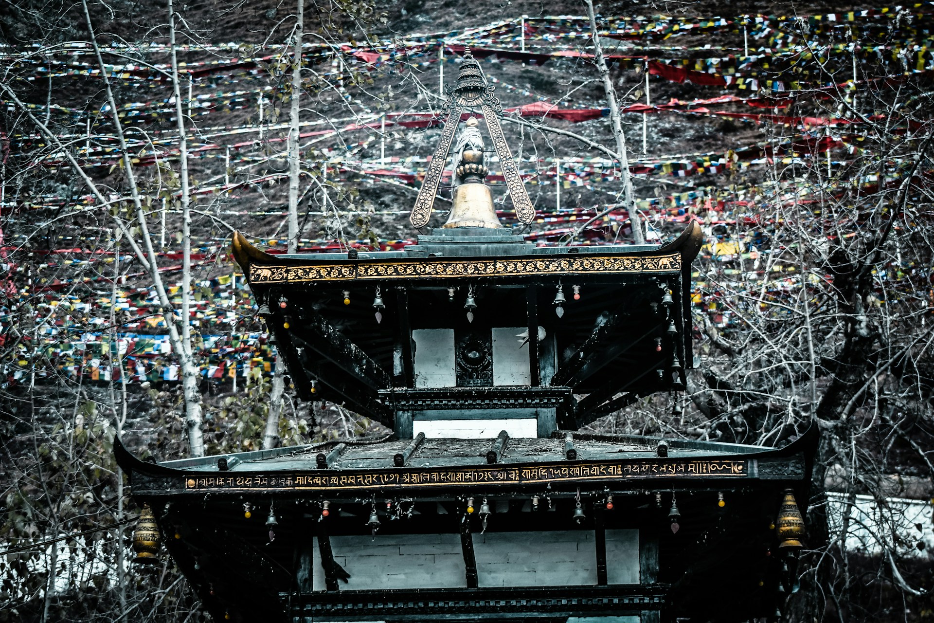
The temple itself is sacred to both Hindus and Buddhists. For Hindus it’s one of the 108 Divya Desams dedicated to Vishnu; for Buddhists it’s known as Chumig Gyatsa, “Hundred Waters,” and connected to Guru Rinpoche, who is said to have meditated there before carrying Buddhism into Tibet. Its religious weight is a large part of why so many visitors arrive as pilgrims rather than trekkers — a distinction that matters when we talk about altitude preparedness, because pilgrims often skip the acclimatization habits that trekkers take for granted.
The Physiology Behind the Number: What Altitude Actually Does to Your Body
A number like “3,800 meters” doesn’t mean much until you connect it to what’s actually happening inside your chest. Air pressure drops steadily as you gain elevation, and with it, the amount of oxygen available in each breath — not because the percentage of oxygen in the atmosphere changes (it stays at roughly 21% everywhere), but because the air itself becomes less dense, so each lungful contains fewer oxygen molecules.
| Altitude | Approx. available oxygen vs. sea level | What it typically feels like |
|---|---|---|
| Sea level (0 m) | 100% | Baseline |
| Kathmandu (1,400 m) | ~85% | Usually unnoticeable |
| Pokhara (820 m) | ~91% | Usually unnoticeable |
| Jomsom (2,720 m) | ~73% | Mildly noticeable breathlessness on exertion |
| Muktinath (3,700–3,800 m) | ~64–65% | Noticeable breathlessness on stairs/inclines; possible mild AMS symptoms |
| Thorong La (5,416 m) | ~52–55% | Significant effort required even at rest; genuine altitude risk zone |
At Muktinath’s altitude, your body responds by breathing faster and deeper, increasing your heart rate slightly even at rest, and — over a few days — producing more red blood cells to carry oxygen more efficiently. That last adaptation takes longer than most visitors stay, which is exactly why the first 24–48 hours at a new altitude are the ones that matter most. You’re not fully acclimatized yet; you’re running on your body’s short-term coping mechanisms, which is precisely the window where mild symptoms show up.
This is also why altitude affects everyone differently, and why fitness, age, and even how well you slept the night before all interact with how you feel at 3,800 meters. None of it is predictable with certainty — which is exactly why the guidance throughout this article leans on ascent rate and self-monitoring rather than trying to guess who will and won’t feel anything.
Medical Support and Facilities Near Muktinath
One question we get often, especially from older pilgrims and from parents traveling with children, is what happens if something does go wrong at this altitude. It’s a fair thing to plan around rather than hope you never need.
Ranipauwa and the wider Muktinath area, being a major pilgrimage destination, has basic health posts and lodges accustomed to dealing with mild altitude complaints — most teahouses and hotel staff in the region have seen enough cases of AMS to recognize it and to know that rest and, if needed, descent are the standard response. Oxygen cylinders are available at some lodges and health posts in the wider Mustang region, though not universally, and shouldn’t be relied on as a first response to symptoms — descent is still the most effective treatment for anything beyond mild discomfort.
For anything more serious than mild AMS — persistent vomiting, confusion, breathlessness at rest — the standard response in this part of Nepal is descent to a lower altitude as quickly as safely possible, combined with medical evacuation by road or, in more remote or urgent cases, helicopter, typically coordinated through your guide, hotel, or trekking agency along with local health posts in Jomsom. This is one of several reasons experienced operators recommend traveling with a licensed guide in this region rather than attempting an independent same-day dash to Muktinath, particularly for travelers in higher-risk categories.
Travel insurance that explicitly covers high-altitude trekking and emergency evacuation is worth confirming before you go — standard travel insurance policies sometimes exclude altitudes above a certain threshold (commonly 3,000–4,000 meters), which would put a Muktinath trip right on the edge of what’s covered depending on your policy’s fine print.
Muktinath Altitude vs Other Himalayan Pilgrimage and Trek Destinations
Muktinath isn’t the only high-altitude sacred site in the Himalayas, and comparing it to a few others helps calibrate expectations if you’ve heard altitude horror stories that don’t actually apply here.
| Destination | Altitude | How it compares to Muktinath |
|---|---|---|
| Gosaikunda Lake, Nepal | ~4,380 m | About 600–650 m higher; a more demanding multi-day trek |
| Kedarnath Temple, India | ~3,583 m | Slightly lower than Muktinath, similar altitude-risk profile |
| Mount Kailash kora, Tibet | Up to ~5,630 m at Dolma La pass | Substantially higher and more physically demanding than a Muktinath visit |
| Annapurna Base Camp, Nepal | ~4,130 m | Moderately higher; multi-day trek with built-in acclimatization |
| Muktinath Temple | ~3,700–3,800 m | Reachable by vehicle in hours, which is exactly why it carries more risk than its modest altitude alone would suggest |
The pattern worth noticing here is that Muktinath’s altitude, on paper, is unremarkable compared to several other Himalayan pilgrimage sites — several sit meaningfully higher. What sets Muktinath apart is accessibility: because you can reach it by flight and jeep in a matter of hours rather than days of walking, it’s one of the few places at this elevation where travelers regularly skip the gradual ascent that destinations like Annapurna Base Camp or the Kailash kora force on you simply by being remote. The altitude number is moderate; the speed at which people reach it is what pushes the real-world risk higher than the number alone suggests.
Muktinath Altitude Compared to Everywhere Else on the Route
Numbers mean more with context. Here’s how Muktinath’s altitude stacks up against the places you’ll pass through to reach it, and a few well-known reference points.
| Location | Altitude | Notes |
|---|---|---|
| Kathmandu | ~1,400 m | Starting point for most itineraries |
| Pokhara | ~820 m | Lower than Kathmandu; usual gateway to Mustang |
| Jomsom | ~2,720 m | Airport town; last major stop before the final climb |
| Kagbeni | ~2,804 m | Optional stop on the trekking route |
| Jharkot | ~3,519 m | Historic village just below Muktinath |
| Ranipauwa (Muktinath village) | ~3,710 m | Where you sleep and where the jeep road ends |
| Muktinath Temple | ~3,762–3,800 m | The shrine complex itself, highest point most visitors reach |
| Thorong La Pass | 5,416 m | The high point of the Annapurna Circuit, well beyond Muktinath |
| Everest Base Camp | ~5,364 m | For scale — nearly 1,600–1,650 m higher than Muktinath |
The most useful line in that table isn’t the top or the bottom — it’s the jump from Pokhara (820 m) to Jomsom (2,720 m). That’s a gain of roughly 1,900 meters, most of it covered in a 20-minute flight or a single day’s drive. It’s this jump, not the final push to Muktinath, that catches most travelers off guard.
Does the Altitude at Muktinath Cause Altitude Sickness?
Muktinath’s altitude of roughly 3,700–3,800 meters sits inside what mountain medicine generally treats as a moderate-risk zone. Acute Mountain Sickness (AMS) can begin to appear from around 2,500 meters upward, and the risk climbs the faster you gain height and the higher you go. At 3,800 meters, you’re high enough that AMS is a real possibility, but nowhere near the altitude — 5,000 to 6,000 meters and above — where the more dangerous forms, High Altitude Pulmonary Edema (HAPE) and High Altitude Cerebral Edema (HACE), become serious threats. Those conditions are far more associated with Thorong La (5,416 m) than with Muktinath itself.
In plain terms: Muktinath altitude sickness is usually mild if it happens at all, and it happens because of how fast you got there, not because 3,800 meters is inherently extreme.
The travelers who run into trouble are almost always the ones who fly from Kathmandu or Pokhara straight to Jomsom and then push on to Muktinath the same day, or the next morning, without a buffer day. That itinerary takes you from under 1,000 meters to nearly 3,800 meters in about 24–36 hours — a rate of ascent that would concern a doctor at any altitude, let alone one this high.
Typical mild symptoms show up as a dull headache, slight nausea, unusual tiredness, disturbed sleep, or a loss of appetite — usually within the first 6–24 hours after arriving in Jomsom or Muktinath. These are your body’s normal adjustment signals, not an emergency, and they typically fade within a day or two if you don’t push higher too quickly.
Symptoms that need attention include a headache that doesn’t respond to standard painkillers, repeated vomiting, noticeable shortness of breath at rest, confusion, or loss of coordination. These are less common at Muktinath’s altitude than at Thorong La, but they’re not impossible, particularly in travelers who arrived from sea level within the last day or two.
Who Should Be Extra Careful at This Altitude
Muktinath draws a genuinely mixed crowd — elderly pilgrims on a religious journey, families with children, honeymooners doing a scenic loop, and serious trekkers finishing the Annapurna Circuit. That mix matters, because the people most likely to struggle with the altitude aren’t the ones you’d expect.
- Elderly pilgrims flying in for a short visit. This is the group we watch most closely at Trek Trove Nepal. Many older visitors travel to Muktinath specifically for religious reasons, often on a tight schedule, and are far more likely to skip a rest day than a trekker would be. Age itself isn’t the main risk factor for AMS — ascent speed is — but older travelers are statistically more likely to have an itinerary that ascends too fast.
- Anyone with a heart or lung condition. Reduced oxygen at 3,700–3,800 meters puts more strain on the cardiovascular and respiratory systems. This isn’t a reason to avoid Muktinath, but it is a reason to speak with a doctor beforehand and to build in slower ascent days.
- Travelers with a prior history of AMS. If you’ve had altitude sickness before, even at a lower elevation than Muktinath, you’re more likely to get it again. Plan a slower itinerary and consider discussing preventive medication with a travel doctor.
- Anyone flying directly from sea-level countries. If your last stop before Nepal was a coastal city, your body has zero acclimatization built in. A day or two in Kathmandu (1,400 m) or Pokhara (820 m) before heading toward Mustang genuinely helps.
- Children. Kids can develop AMS just like adults, but they’re often less able to describe symptoms clearly. Watch for irritability, unusual clinginess, loss of appetite, or disturbed sleep as possible early signs in younger travelers.
None of this means these groups should avoid Muktinath. It means their itineraries should build in more buffer than a fit 25-year-old trekker’s itinerary needs.
How the Altitude Shapes Your Route to Muktinath
There are three realistic ways to reach Muktinath, and each one interacts with the altitude differently.
| Route | Altitude profile | Typical time | Best for |
|---|---|---|---|
| Flight to Jomsom + jeep | Jumps from ~800m to ~2,720m in 20 minutes, then to ~3,710–3,800m by jeep in under an hour | 2–2.5 hours total from Pokhara | Time-limited pilgrims, but highest AMS risk if done same-day |
| Jeep/private car via road | Gradual climb from Pokhara through Beni, Tatopani, and Ghasa before reaching Jomsom and Muktinath | 6–8 hours driving, ideally split over 2 days | Groups wanting a scenic, moderate-risk overland route |
| Trekking (Annapurna Circuit or Jomsom–Muktinath trek) | Multi-day walk with natural acclimatization built in | 4–5 days minimum on foot | Trekkers and anyone wanting the lowest altitude-related risk |
The flight-and-jeep option is by far the most popular because it’s fast, but it’s also the option most likely to trigger AMS symptoms, simply because of how quickly it changes your elevation. If you’re taking this route, the single most effective thing you can do is spend a full extra day in Jomsom (2,720 m) before continuing up to Muktinath, rather than treating the whole trip as a same-day dash.
The overland jeep route is a genuinely underrated middle option. It takes longer, but the days spent at intermediate altitudes — Tatopani at roughly 1,190–1,290 meters, Ghasa and Marpha in the low-to-mid 2,000s — give your body a staged introduction to altitude instead of a single jolt.
Trekking remains the gold standard for altitude safety, not because walking is magic, but because it physically limits how fast you can gain elevation. You simply can’t outpace your acclimatization on foot the way you can in a jeep or a plane.
A Realistic Day-by-Day Altitude Profile
Here’s what a sensible altitude progression looks like on a common Pokhara–Jomsom–Muktinath itinerary, whether you’re flying or driving the first leg:
| Day | Location | Altitude | What’s happening physiologically |
|---|---|---|---|
| 1 | Kathmandu | 1,400 m | Baseline, minimal altitude effect |
| 2 | Pokhara | 820 m | Slight drop; still low risk |
| 3 | Jomsom | ~2,720 m | First real altitude jump; mild symptoms possible |
| 4 | Kagbeni (optional) or rest in Jomsom | ~2,720–2,804 m | Acclimatization buffer day |
| 5 | Muktinath (via Jharkot) | 3,519 m → 3,710–3,800 m | Main altitude challenge of the trip |
| 6 | Return to Jomsom or onward to Marpha | 2,720–3,772 m | Descent begins to relieve altitude strain |
Notice that the biggest single jump on this whole table — from Pokhara to Jomsom — happens before you’ve even reached Muktinath. That’s worth internalizing: most of the altitude adjustment work for this trip happens before you arrive at the temple, not because of it.
Best Time to Visit Muktinath, Altitude and Weather Considered
Altitude and season interact more than most guides admit. The thinner air at 3,700–3,800 meters is a constant, but temperature, wind, and snow change dramatically by month, and cold weather makes altitude symptoms feel worse than they mechanically are.
| Season | Months | Conditions at Muktinath’s altitude | Altitude-related notes |
|---|---|---|---|
| Spring | March–May | Mild days, cold mornings/nights, generally clear | Good acclimatization conditions; popular season |
| Summer/Monsoon | June–August | Mustang is in a rain shadow, so it stays relatively dry, but visibility can be poor from cloud elsewhere on the route | Lower crowd, still requires the same ascent caution |
| Autumn | September–November | Clear skies, stable weather, cold but comfortable | Widely considered the best window; easiest to acclimatize predictably |
| Winter | December–February | Very cold, possible snow and road closures at higher points | Fewer AMS reports simply because fewer people go this fast, but cold stress compounds altitude discomfort |
If you’re already managing altitude adjustment, autumn’s stable weather makes it easier to add a buffer day without your plans being derailed by storms — a real advantage over winter, when road closures can force you into faster ascents than planned just to avoid getting stuck.
Acclimatizing Properly: A Practical Framework
You don’t need a medical degree to acclimatize sensibly for Muktinath. You need a handful of habits, applied consistently.
- Build in one buffer day at Jomsom or Pokhara before pushing to Muktinath, especially if you’re flying. This single change does more for altitude comfort than any supplement or gadget.
- Ascend gradually where you have the choice. If you’re driving, consider overnighting at an intermediate stop like Tatopani or Marpha rather than doing Pokhara–Muktinath in one long push.
- Hydrate more than feels necessary. Thin, dry mountain air increases fluid loss through breathing alone; aim for noticeably more water than you’d drink at sea level, and go easy on alcohol, which worsens dehydration and disrupts sleep at altitude.
- Eat enough, even without much appetite. Appetite naturally drops at altitude, but your body needs the calories more, not less, while it’s working harder to process oxygen.
- Sleep at the same altitude or lower than you climbed to that day wherever your itinerary allows — the old mountaineering rule of “climb high, sleep low” still applies loosely even on a jeep-based trip.
- Avoid sedatives and sleeping pills at altitude unless specifically cleared by a doctor, since some can suppress breathing further during sleep.
- Consider discussing acetazolamide (Diamox) with a travel doctor before you go, particularly if you have a history of AMS or a compressed itinerary that doesn’t allow for buffer days.
None of these guarantee you won’t feel anything at 3,800 meters — a mild headache or slightly disrupted sleep on your first night is common and not usually cause for concern. The goal is keeping mild symptoms mild, and catching anything more serious early.
Symptoms to Watch and What To Do About Them
| Severity | Symptoms | What to do |
|---|---|---|
| Mild | Slight headache, mild nausea, tiredness, poor sleep | Rest, hydrate, avoid climbing higher until symptoms ease; usually resolves in 24–48 hours |
| Moderate | Headache unrelieved by paracetamol, vomiting, noticeable fatigue, loss of appetite | Stop ascending immediately; consider descending; monitor closely; seek medical advice if not improving |
| Severe (possible HAPE/HACE) | Breathlessness at rest, confusion, loss of coordination, persistent cough, blue-tinged lips or fingernails | Descend immediately and seek emergency medical help — do not wait to see if it passes |
The single rule that covers almost every scenario: never ascend further while you have unresolved symptoms. Most altitude problems at Muktinath’s elevation are prevented not by fitness or willpower, but by that one decision — waiting a day, rather than pushing on because the itinerary says so.
What to Pack for Muktinath’s Altitude and Climate
Because Muktinath combines high altitude with a dry, wind-exposed rain-shadow climate, the packing list is shaped as much by wind and temperature swings as by elevation itself.
- Layered clothing — a moisture-wicking base layer, an insulating mid-layer (fleece or light down), and a windproof/water-resistant outer shell. Temperatures can swing from pleasant midday sun to near-freezing within hours.
- A warm hat and gloves, even outside winter — mornings and evenings at 3,700+ meters are cold year-round.
- Sunglasses with strong UV protection — sun intensity increases with altitude, and the terrain around Muktinath is bright, open, and reflective.
- High-SPF sunscreen and lip balm — thinner atmosphere means less UV filtering.
- A refillable water bottle or hydration bladder, plus water purification tablets or a filter if you’re trekking rather than staying in lodges with bottled/boiled water.
- Comfortable, broken-in walking shoes or light boots — the final stretch from Ranipauwa to the temple is a genuine uphill walk, not a flat stroll.
- A basic first-aid kit including altitude-relevant items: paracetamol, any personally prescribed altitude medication, blister plasters, and rehydration salts.
- A headlamp, useful for early starts and basic hotel/teahouse power reliability in Mustang.
- Modest clothing for the temple visit — shoulders and knees covered, as is expected at religious sites across Nepal.
Overpacking for cold and underpacking for sun is the most common mistake — Mustang’s dry, high-altitude sun is stronger than the chilly air makes it feel.
Getting Fit Before You Go
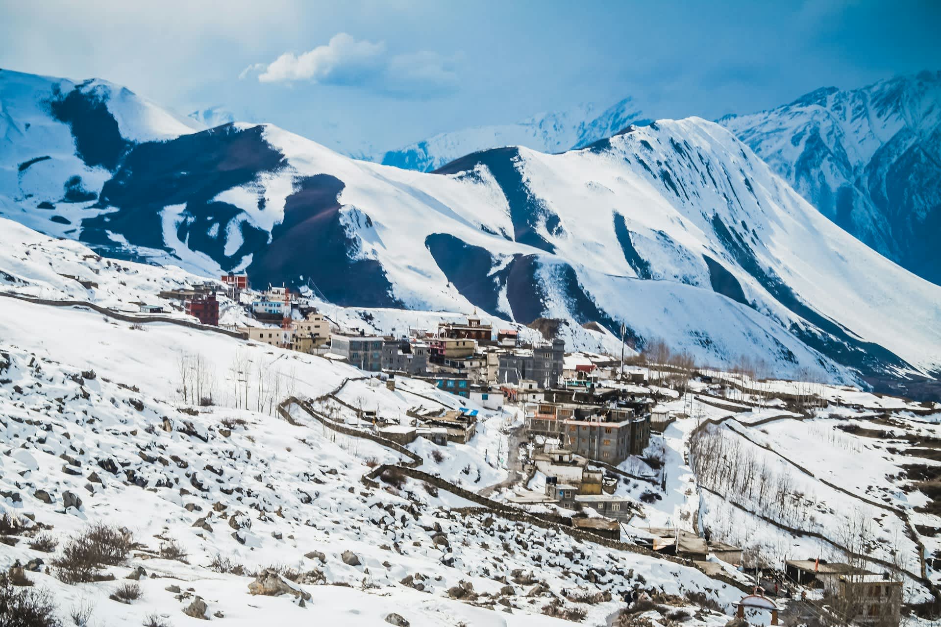
You don’t need mountaineering-level fitness to handle Muktinath’s altitude, but general cardiovascular conditioning genuinely helps your body cope with reduced oxygen, and it makes the final uphill walk from Ranipauwa to the temple far more enjoyable than gruelling.
In the four to six weeks before your trip, regular walking, stair climbing, and light cardio work (even 30–40 minutes a few times a week) make a measurable difference. This isn’t about outrunning altitude sickness — fitness doesn’t prevent AMS, which is caused by ascent speed, not physical condition — but a fitter body handles the general exertion of the trip with less fatigue, which makes it easier to notice and respond to real altitude symptoms instead of just feeling generally worn out.
What the Altitude Actually Feels Like at Muktinath
Numbers and tables only go so far. Here’s the honest, sensory version of what 3,700–3,800 meters feels like for a first-timer, based on what travelers on our trips consistently describe.
Stepping off the jeep or the final stretch of trail at Ranipauwa, the first thing most people notice isn’t their breathing — it’s the wind. Mustang’s afternoon winds are a near-daily feature, funneled up the Kali Gandaki gorge, the deepest gorge on Earth, and they arrive with real force by late morning, dying down again after sunset. That wind, combined with thin, dry air, makes the cold feel sharper than the thermometer suggests, which is part of why layering matters more here than the raw temperature numbers imply.
The breathlessness itself tends to announce itself on stairs and short uphill stretches rather than on flat ground — the walk from Ranipauwa up to the temple courtyard is where most people first notice it, pausing for a breather where they wouldn’t have thought twice at sea level. This is normal, expected, and not a sign anything is wrong; it’s simply your body doing more work per breath than it’s used to.
By evening, many travelers notice a night or two of lighter, more interrupted sleep — a well-documented altitude effect related to changes in breathing patterns during sleep, not necessarily a symptom of AMS on its own unless it comes with the other signs listed earlier in this guide. Appetite often dips too, which is exactly the wrong instinct to follow, since your body needs the calories more, not less, at this elevation.
None of this is meant to alarm you — the overwhelming majority of visitors describe the physical adjustment as mildly uncomfortable for a day, not something that derails the trip. But going in with accurate expectations, rather than assuming you’ll feel exactly as you do at home, is itself part of what prevents mild discomfort from turning into something that spoils the visit.
Cost and Logistics: How Route Choice Affects Both Budget and Altitude Risk
Because the route you choose to Muktinath directly determines how fast you gain altitude, it’s worth looking at cost and altitude risk together rather than as separate decisions.
The flight-plus-jeep route from Pokhara is the most expensive per day but the shortest overall, which sometimes tempts travelers into compressing what should be a two-day approach into one. Flights from Pokhara to Jomsom run seasonally and are subject to weather delays, particularly wind-related cancellations in the early afternoon — another reason experienced travelers fly early morning and build a buffer day into the schedule rather than assuming the flight will run exactly on time.
The overland jeep route costs less overall when split among a group, takes considerably longer, and — as covered earlier — naturally builds in more gradual altitude exposure through stops like Tatopani and Marpha. For travelers who are budget-conscious and not in a rush, this route quietly solves two problems at once: cost and acclimatization.
Trekking is the least expensive per day in raw transport costs but requires the most time, permits (the Annapurna Conservation Area Permit and, depending on your route, a TIMS card), and physical commitment. It remains, for what it’s worth, the route we see the fewest altitude complaints from — not because trekkers are tougher, but because the itinerary format itself prevents the kind of rushed, single-day altitude jump that causes most problems on the faster routes.
Whichever route you choose, the same principle holds: it’s rarely worth saving a single day if that day is the one that would have let your body catch up with the altitude.
Common Myths About Muktinath’s Altitude
“If I’m fit, I won’t get altitude sickness.” Fitness helps with stamina, not with how your body processes lower oxygen levels. Elite athletes get AMS; unfit travelers who ascend slowly often don’t. Ascent rate is the dominant factor, not fitness.
“Muktinath is as dangerous as Everest Base Camp or Thorong La.” It isn’t. At roughly 3,700–3,800 meters, Muktinath sits well below the altitudes where HAPE and HACE become significant risks. It deserves sensible preparation, not the level of concern appropriate for a 5,000+ meter crossing.
“You can’t get altitude sickness if you only stay one night.” You can. AMS symptoms often appear within the first 6–24 hours at a new altitude — which covers exactly the window of a rushed one-night visit.
“Local pilgrims don’t get affected, so foreigners are just being dramatic.” Many Nepali and Indian pilgrims travel to Muktinath from lower-altitude regions and do experience mild symptoms; they’re simply less likely to report them, and cultural framing around pilgrimage sometimes downplays physical discomfort as part of the spiritual effort.
“Drinking alcohol at altitude helps you relax and sleep better.” It does the opposite — alcohol worsens dehydration and can suppress the breathing reflexes your body relies on more heavily at altitude.
Why the Altitude Is Part of the Spiritual Experience, Not Just an Obstacle
It’s worth pausing on something the purely practical sections of this guide skip over: for a large share of visitors, the altitude at Muktinath isn’t just a logistical hurdle to manage — it’s part of the point. Pilgrims have been making this climb for centuries, long before jeeps or flights existed, and the physical effort of reaching 3,700-plus meters has always been understood as part of the devotion itself, not separate from it.
That context doesn’t change any of the physiological advice above — your body doesn’t process oxygen differently because your visit has spiritual meaning — but it does explain a pattern we see often: pilgrims who push through mild discomfort because the difficulty feels appropriate to the journey, rather than pausing the way a trekker with no religious stake in the destination might. If that’s part of why you’re visiting, it’s worth naming that instinct honestly, and still applying the same basic rule: mild discomfort is fine to push through gently, but symptoms that escalate are a signal to rest, not a test to pass.
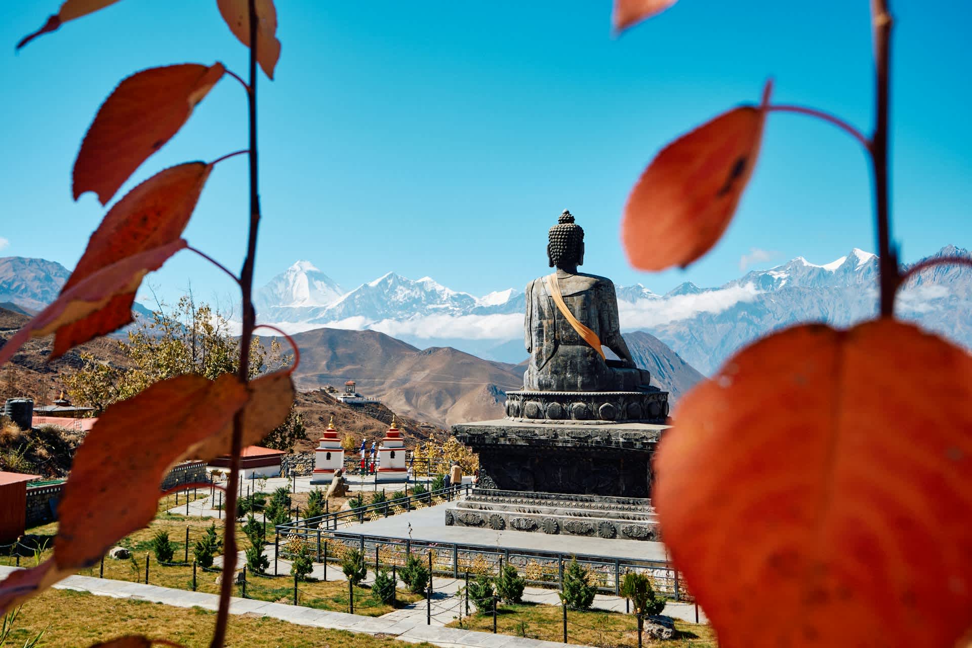
The reward at the top, for what it’s worth, tends to match the effort. The temple courtyard, with its 108 stone spouts running with glacier-fed water believed to wash away sins, sits against a backdrop of the Nilgiri and Dhaulagiri ranges that’s genuinely hard to photograph adequately — the thin, dry air at this altitude tends to produce unusually sharp, high-contrast mountain views, especially in the clear light of early morning before the afternoon wind and haze pick up. Most experienced visitors and guides will tell you the same thing: arrive early if you can, both for the light and because the walk feels easier before the wind builds.
A Note on Altitude Gadgets and Supplements
A reasonable question, given how much altitude-prevention gear is marketed to trekkers: do you need a pulse oximeter, altitude tablets, or specialized supplements for a trip to Muktinath?
A basic pulse oximeter — the small clip-on device that measures blood oxygen saturation — is inexpensive, genuinely useful for monitoring how you’re doing, and worth carrying if you’re in a higher-risk category or simply want objective data rather than guessing. It’s not a substitute for paying attention to symptoms, but it’s a useful second data point, particularly for travelers managing existing heart or lung conditions.
Over-the-counter altitude supplements marketed with vague claims are, honestly, not well supported by evidence at Muktinath’s elevation, and shouldn’t replace the basics: gradual ascent, hydration, and rest. Acetazolamide (Diamox) is the one medication with genuine clinical support for preventing and easing AMS symptoms, and it requires a prescription and a conversation with a doctor beforehand — not something to start experimenting with for the first time mid-trip.
Ibuprofen or paracetamol can help with altitude headaches specifically, but a headache that doesn’t respond to standard painkillers is exactly the kind of symptom that should prompt you to stop ascending, not to reach for a stronger dose.
What We’ve Learned Guiding Pilgrims and Trekkers to Muktinath
Across the itineraries we’ve run into Mustang, the pattern is consistent: it’s almost never the trekkers who struggle with Muktinath’s altitude — they’re usually acclimatizing gradually by design. It’s the short-schedule flight-and-jeep pilgrims, often on a once-in-a-lifetime religious trip with limited days off work, who arrive at Ranipauwa already slightly breathless and assume it’s just the walk.
At Trek Trove Nepal, the single adjustment that changes outcomes most is embarrassingly simple: adding one buffer night in Jomsom before continuing to Muktinath, instead of treating the whole journey as a same-day round trip from Pokhara. It costs a day. It rarely costs anything in enjoyment — Jomsom itself, with its apple orchards and windy afternoon walks along the Kali Gandaki, is worth the stop on its own merits, not just as an altitude buffer.
We build our Muktinath itineraries — whether by jeep, by flight, or on foot as part of a longer Annapurna Circuit trek — around that principle, with realistic daily altitude gains, honest guidance on who should add extra acclimatization time, and support on the ground if symptoms do appear.
Frequently Asked Questions about Muktinath Altitude
1. What is the exact altitude of Muktinath? Muktinath is generally described as sitting between 3,710 and 3,800 meters. Ranipauwa, the village where most travelers stay, is at 3,710 m; the temple complex itself is surveyed at approximately 3,762 m, with 3,800 m used as a commonly rounded figure for the highest point visitors reach.
2. Is Muktinath higher than Everest Base Camp? No. Everest Base Camp sits at roughly 5,364 meters, nearly 1,600 meters higher than Muktinath. Muktinath is significantly lower and generally considered a much easier altitude to manage.
3. Can you get altitude sickness at Muktinath? Yes, it’s possible, though it’s usually mild. The risk comes mainly from ascending too quickly — particularly flying to Jomsom and continuing to Muktinath the same day — rather than from the altitude itself being extreme.
4. Do I need Diamox (acetazolamide) to visit Muktinath? Not necessarily for everyone, but it’s worth discussing with a travel doctor before your trip, especially if you have a history of altitude sickness, a compressed itinerary without buffer days, or underlying health conditions.
5. How high is Jomsom compared to Muktinath? Jomsom sits at approximately 2,720 meters, roughly 1,000–1,080 meters lower than Muktinath. This is the main altitude jump most travelers face before continuing up to the temple, and it’s also the jump most itineraries underestimate — the flight from Pokhara takes about 20 minutes, which doesn’t give your body any real time to adjust before you’re already at nearly 2,720 meters.
6. What’s the altitude difference between Pokhara and Muktinath? Pokhara sits at around 820 meters, while Muktinath sits at roughly 3,700–3,800 meters — a difference of about 2,900 meters, usually covered over 1–2 days by flight and jeep, or several days on foot.
7. Is it safe for elderly people to visit Muktinath given the altitude? Many elderly pilgrims visit Muktinath safely every year. The key factors are ascent speed and any existing heart or lung conditions, not age alone. Building in a buffer day at Jomsom and consulting a doctor beforehand are the most useful precautions.
8. How long does it take to acclimatize to Muktinath’s altitude? Mild symptoms, if they occur, typically resolve within 24–48 hours of arriving. A one-night buffer at an intermediate altitude like Jomsom before continuing to Muktinath significantly reduces the chance of symptoms appearing at all.
9. Can children get altitude sickness at Muktinath? Yes, children can be affected the same way adults are, though they may express symptoms differently — irritability, clinginess, or poor sleep rather than clearly describing a headache or nausea. It’s worth checking in with them specifically rather than assuming they’ll tell you if something feels off, since younger children especially may not have the vocabulary to describe a mild headache or nausea clearly.
10. What altitude is Thorong La Pass compared to Muktinath? Thorong La sits at 5,416 meters, roughly 1,600–1,700 meters higher than Muktinath. It carries a considerably higher altitude sickness risk and is a separate, more demanding challenge from a Muktinath visit alone.
11. Is the walk from Ranipauwa to Muktinath Temple physically difficult because of altitude? The walk itself is short — around 10 to 20 minutes uphill — but it can feel more strenuous than its length suggests because you’re already at roughly 3,700 meters. Taking it slowly is normal and expected, even for fit travelers.
12. What’s the best route to Muktinath if I’m worried about altitude? The overland jeep route with an overnight stop partway, or a multi-day trek, both allow more gradual acclimatization than flying directly to Jomsom and continuing to Muktinath the same day.
13. Does the altitude at Muktinath affect breathing even if I don’t get AMS symptoms? Yes, mild breathlessness on exertion is normal at this altitude even without developing AMS — the air simply carries less oxygen per breath. It’s not usually a warning sign on its own unless it occurs at rest or worsens.
14. When is the best time to visit Muktinath to minimize altitude-related discomfort? Autumn (September to November) generally offers the most stable weather, which makes it easier to stick to a gradual acclimatization schedule without storms or road closures forcing a rushed ascent. Spring (March to May) is a close second.
Final Word on Muktinath Altitude
Muktinath’s altitude isn’t the story most people expect it to be. It’s high enough to notice, high enough to deserve a real plan, and high enough that rushing it is the actual risk — not the number itself. Most of the altitude-related discomfort we see traces back to one decision: trying to do Pokhara to Muktinath and back in a single tight loop instead of giving the body one buffer day.
Build that day in, hydrate properly, pack for both cold and strong sun, and pay attention to how you feel rather than to the clock — and 3,700 to 3,800 meters becomes a genuinely manageable, memorable part of the journey rather than the thing you spend it worrying about.